Rain Returns to Central Florida as Election Day Approaches
Floodwaters linger in coastal areas while scattered showers threaten voter travel routes on Tuesday.
By Eric Collins ·
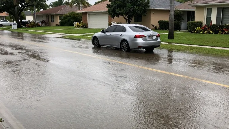
The heaviest rains have stopped, but the water is not gone yet.
Monday brought catastrophic flooding to parts of Central Florida. The National Weather Service issued a Flood Watch for coastal counties and Okeechobee County. That watch remains active until 10 a.m. on Tuesday. Residents should expect slow receding of floodwaters. Additional rain could worsen the situation in low-lying areas.
Tuesday will bring scattered downpours. Rain chances stand at 50% to 60% for the region. Most locations will see less than one inch of precipitation. Isolated spots may receive between 1.5 and 2.5 inches. Drivers heading to the polls should allow extra travel time. The day will feature occasional sunshine and breezy east winds. High temperatures will reach the lower 80s.
Wednesday marks the beginning of a gradual improvement. Rain chances will drop to 20% along the coast and 30% to 50% inland. An isolated thunderstorm is possible. Highs will climb into the lower to middle 80s as the atmosphere dries out.
Thursday through the weekend looks considerably drier. Rain chances will fall to 20% or less. Skies will be partly to mostly sunny. Highs will remain in the lower to middle 80s. Humidity will gradually decrease. A weak front may pass through Friday or Saturday, but it will not provide much cooling.
A stronger cold front is expected to arrive early next week. This system will bring a few showers followed by noticeably cooler weather. Highs will stay below 80 degrees next Tuesday. Overnight lows could dip into the 50s. The National Hurricane Center is monitoring an area northeast of the Bahamas for possible subtropical development. Formation odds are 30% over seven days. No direct Florida threat is expected, though the system could contribute to renewed rough surf this weekend.
Dangerous rip currents and rough surf continue along Atlantic beaches. Seas of 5 to 7 feet will subside gradually through Thursday. Another round of powerful Atlantic swell arrives Friday night into Saturday. The National Weather Service recommends staying out of the ocean.
Source: WOFL · original report published