
Coastal flood warning holds as rain chances surge across Central Florida
Deep moisture from the south pushes precipitation odds to 70 percent, while 14-foot seas and king tides threaten beaches through the weekend.
By Victoria Hayes ·
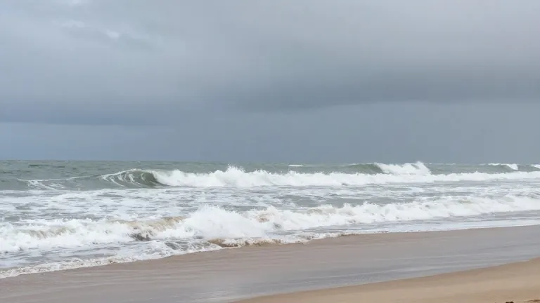
A tight pressure system is driving strong northeast winds and a surge of moisture into Central Florida, raising the risk of localized flooding and keeping hazardous beach conditions in place through the weekend.
The Weather Prediction Center has placed eastern portions of the region under a Marginal Risk for excessive rainfall. Rain chances have climbed to between 40 and 70 percent, driven by scattered showers and isolated storms organizing into fast-moving bands. These bands are capable of producing quick, heavy downpours, with localized street flooding most likely south of Cape Canaveral.
On the coast, seas will remain at 9 to 14 feet today before subsiding to 6 to 9 feet on Thursday. Breaking waves of 7 to 10 feet are causing moderate to major beach erosion and creating a high risk of life-threatening rip currents. King tides combined with the onshore flow are producing minor to moderate coastal flooding around high tide.
Gusts of 30 to 35 miles per hour are possible along the shoreline, while sustained winds remain around 15 to 20 miles per hour. The pressure gradient between the high pressure to the north and lower pressure near the Bahamas is responsible for the gusty flow, though winds are expected to ease slightly by Thursday and Friday.
Temperatures will remain warm and humid across the region. Afternoon highs today will range from the upper 70s to the mid 80s, with the coolest readings found along the immediate coast. By Friday and Saturday, highs in the Orlando metro and interior areas are expected to climb into the mid to upper 80s. Overnight lows will hold in the low to mid 70s along the coast and the upper 60s to around 70 degrees inland.
The National Hurricane Center reports that the Atlantic remains quiet near the Florida coast. A low-pressure area near the Bahamas is currently helping to drive the breezy onshore flow and moisture, but it is not an organized tropical system. Forecasters expect no tropical development across the Gulf, Caribbean, or Atlantic over the next seven days, leaving no tropical threats to Florida or the U.S. mainland.
Source: WOFL · original report published